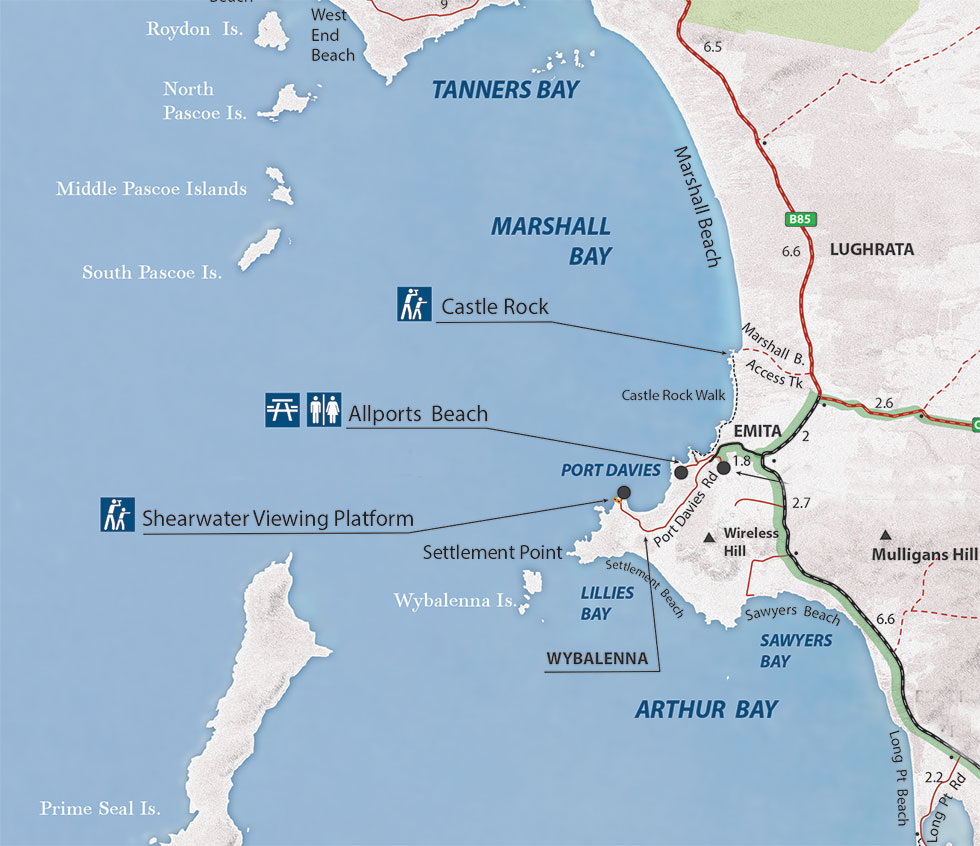
Emita is a place of shared stories - of dual narratives embracing both sadness and opportunity.
The sadness here is anchored in the decades of the 1830s/40s when the Wybalenna settlement was established just to the west of here on the coastal section that became known as Settlement Point. During this time Aboriginal people were forcibly relocated here from their Country on mainland Tasmania.
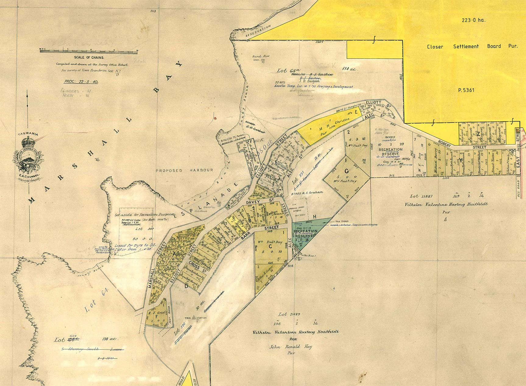
From the 1890s onwards, the precinct became home to new settlers as lands on Flinders Island were opened up for closer settlement. It was here that Valentine and Tilly Huitfeldt made their home and dreamed up their plans for a major new island village hub called Emita. As the early town plans from 1911 clearly show however – things didn’t quite work out as planned.
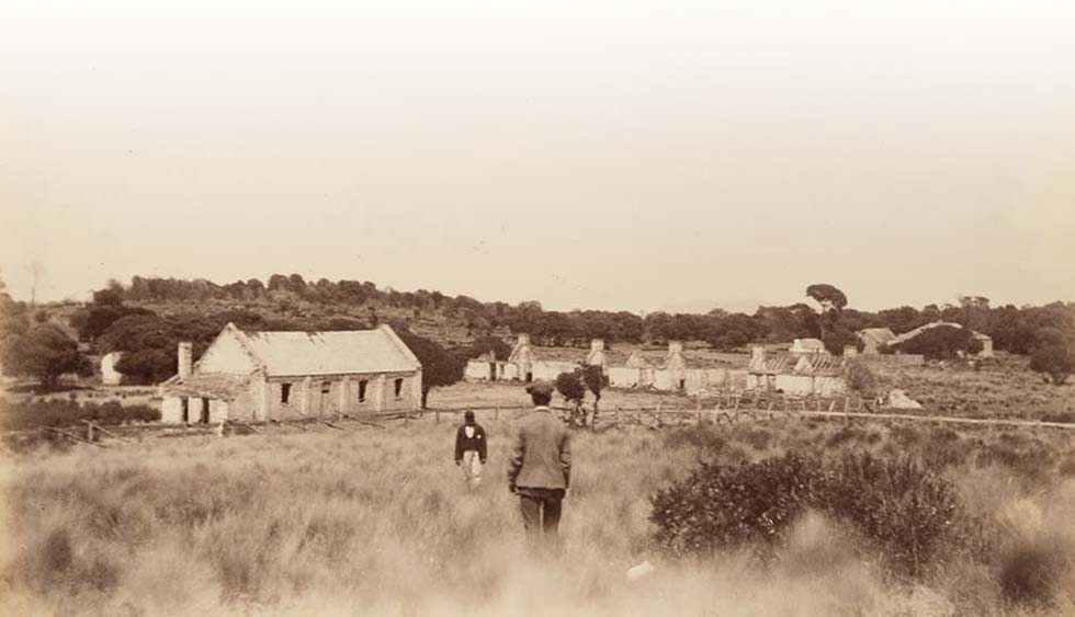
Wybalenna is one of the most significant historical places in Tasmania.
Between 1833 and 1847 it housed 134 Aboriginal people who were transported here from mainland Tasmania. The death toll amongst the devastated community was tragically high.
When the failed experiment ended in 1847, the 47 surviving Aboriginal people were relocated to Oyster Cove south of Hobart.
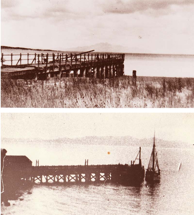
Following the closure of the Wybalenna settlement in the 1840s, the Settlement Point / Port Davies precinct remained a base for commercial activities including kangaroo hunting. The first official jetty on the island was built facing southwards at Lillies Bay in 1891/92.
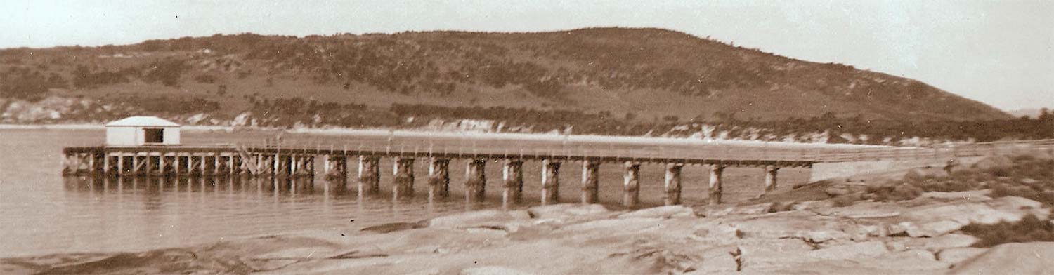
With the establishment of Emita after 1911, a new wharf was built alongside the new township facing north out across Port Davies. It operated until 1939 when the new Port Davies Wharf was opened.
This remained in use up until the 1970s.
Among the wave of new settlers to arrive and take up land on Flinders Island in 1891 was the first warden on the island – Valentine Huitfeldt and his wife Tilly.
They built their first house near here, a mile to the east of the former Wybalenna settlement.
Then in 1903 they moved into their new, more spacious residence – ‘Throndstad’ – on their farmland across from Castle Rock.
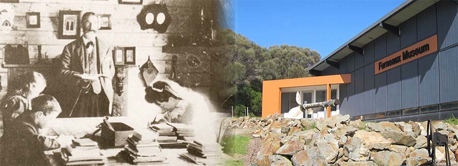
It was here on the front porch of their family home that the party of dignitaries we see above was photographed in January 1911. Included in the official party were the Tasmanian Governor, the Premier and also the Minister for Lands.
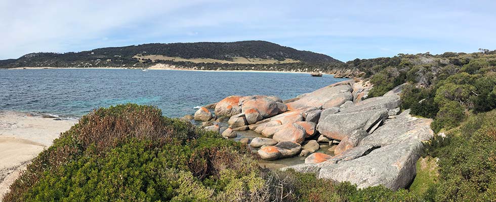
Today’s Emita landscape has echoes sounding back to the town’s establishment around the time of First World War. Allports Beach is named after Dr Allport who operated the first cottage hospital at Stella Maris after this building was constructed by the Huitfelds.
The first public school at Emita was run by the alcoholic principal Walter Lyall. He named the building Dryazell because it was such a long horse ride to get his grog at Whitemark. This original schoolhouse forms part of the buildings comprising the Furneaux Museum.
More about Emita ...
When new charts of Bass Strait were drawn up from the 1840s onwards, Settlement Point described the prominent land outcrop on the west coast of Flinders Island.
An earlier 1820s map shows the landform as Pea Jacket Point.
What resemblance it had to the Pea Jackets worn by sailors is hard for us to imagine, but the map does show very clearly the expanse of grassy land that naturally occurred on the scrub, sandy soils that offered “good sheep pasturage”.
As Charles Gould was later to write in 1871, ground like this occurring naturally on Flinders Island was a very rare commodity.
He noted that: “The true grassy portions of Flinders are restricted and patchy, the most important being situated on the extreme north end of the island, opposite to the Sisters, and in the vicinity of the settlement... The smaller islands seem to be those best adapted for pastoral purposes, and most of them produce a rough coarse grass on which sheep manage pretty well.”
The natural grasslands found in this area help explain its choice as the location for the Wybalenna Aboriginal settlement that operated on this site from 1832 – 1847.
Following the closure of the settlement at Wybalenna, the property was later reported in a scientific paper of 1879 as being the home of “Mr. Gardiner, of Launceston, who has also a lease of the whole island.”
Thereafter closer settlement of the Emita area occurred in the years leading up to the First World War with the island’s wireless station being built here in 1913.
A town reserve map from 1910 shows the creation of the precinct needed to form up the Emita township. Essential services for the community were delivered via the main wharf (now demolished) facing north into the sheltered waters of Port Davey immediately to the west.
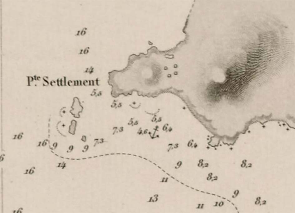
Settlement Point as shown on 1850s chart

1820 map of Pea Jacket (now Settlement) Point
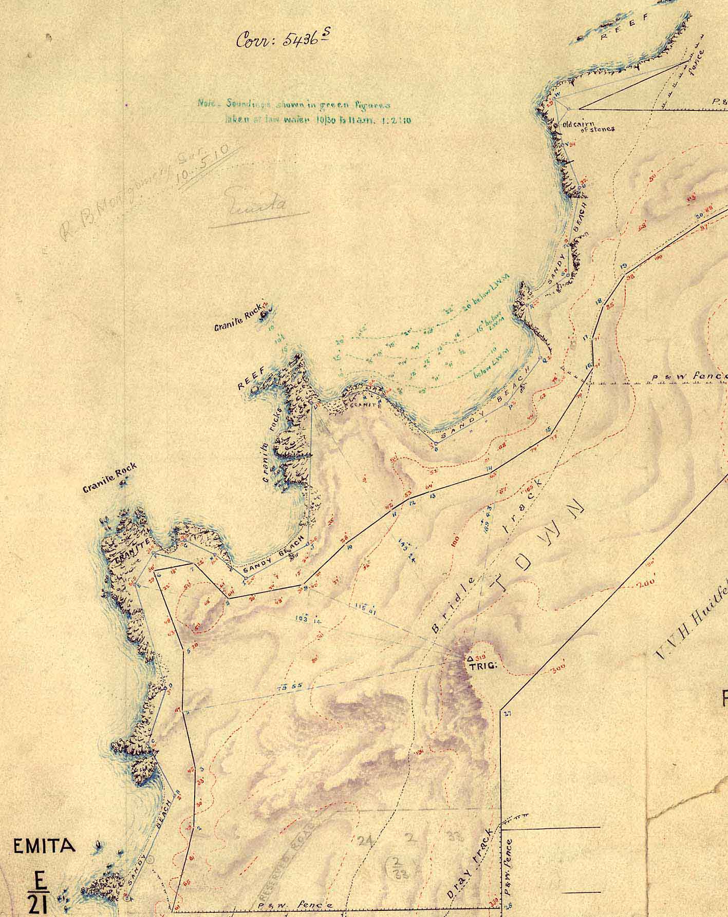
Plan of Emita town reserve, Flinders Is, parish of lenna, May 1910.
The Furneaux Museum ...
If you are interested in learning more about the Tasmanian Aborigines and Wybalenna check out the following references which are available at the Furneaux Museum
Watch: Black Man’s Houses (DVD)
Read:
• Way to Wybalenna Glennis Slack-Smith and Yvonne McBurney 1991
• Moonbird People Patsy Adam Smith 1965
• Grease and Ochre Patsy Cameron 2011
• Me Write Myself Leonie Stevens 2017
The museum started with a three-roomed cottage built in 1908 as a school room and residence for Walter Hamilton Byng Lyall, the first schoolteacher on Flinders Island.
Walter Lyall’s private school is significant as the first government-subsidised school on Flinders Island.
Lyall was an alcoholic and he named the building Dryazell as it was a long way to Whitemark to get his supplies. When the Museum opened In Dryazell in 1965 the cottage was owned by Mr Richard Fowler, a keen historian, who was using the building as an office to write a history of the Furneaux Group beginning with the discovery of the island by Tobias Furneaux in 1773.
On his death his wife, Iola Fowler. arranged for the cottage and heritage collection to be handed over to the Flinders Island Council and the community in 1978.
Today the Funeaux Museum showcases the history of the Furneaux group of islands. Relics from shipwrecks and other artefacts are housed in seven buildings which themselves are exhibits. The museum has artefacts from some of Australia’s earliest European settlements such an anchor from the Sydney Cove wrecked on Preservation Island in 1797.
The dark history of the Wybalenna settlement is recorded in the Aboriginal Room, together with an exquisite collection of Aboriginal shell necklaces. A collection of albums and photographs cover all aspects of life in the Furneaux Group and provide an invaluable tool for researchers.
The town that wasn't ...
With its north facing location, outstanding beaches and great views Emita was the obvious place to establish the main settlement on the island.
A town reserve map from 1910 shows the creation of the precinct needed to form up the Emita Township. Roads were mapped out and blocks marked for what was intended to be the central township of the island.
However, the township never grew as expected and this was down to two main reasons:
1. A lack of a reliable fresh water source
2. The hotel being built at Whitemark to service the people coming in from the outer islands for their supplies.
Some development occurred in the years leading up to the First World War with the island’s wireless station being built here in 1913. And later came a post office shop. Essential services for the growing community were delivered via the main wharf (now demolished) facing north into the sheltered waters of Port Davey immediately to the west. Today Emita with its stunning beaches is a popular location for the homes of locals and holiday makers.