PILLINGERS PEAK
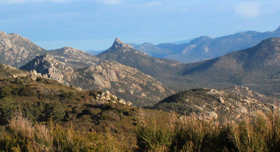
A striking feature
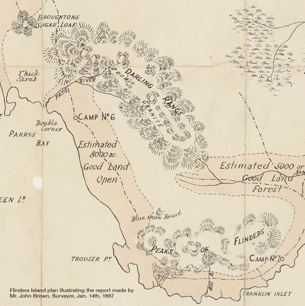
Up until the mid 1880s, no one had troubled too much about the names of the features within Flinders Island. Prior to smaller blocks being opened up for free selection, hardly anyone lived here and those who did didn't need a map to help them get around.
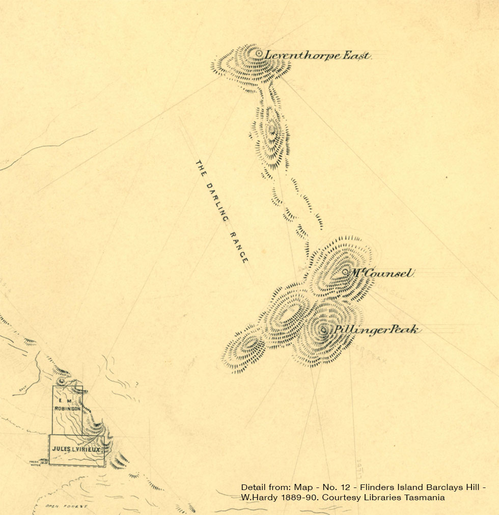
This state of affairs is captured in a map of the island done in 1887 showing how none of the landmarks along the Darling Range were accorded their own title at that time.
Two years later when a very detailed survey map of the southern end of the island was produced, several of the main peaks along the range had acquired a title. One of these was Pillingers Peak standing guard over the break in the granite ranges separating out the Darling Range from the Peaks of Flinders / Srzelecki Range to the South
This most likely alludes to one Mr Alfred Taouias Pillinger. Pillinger was the M.H.A. for Oatlands and the Minster for Lands at the time when the island underwent the dramatic upheaval of being opened up for closer settlement.