DARLING RANGE
Darling Range
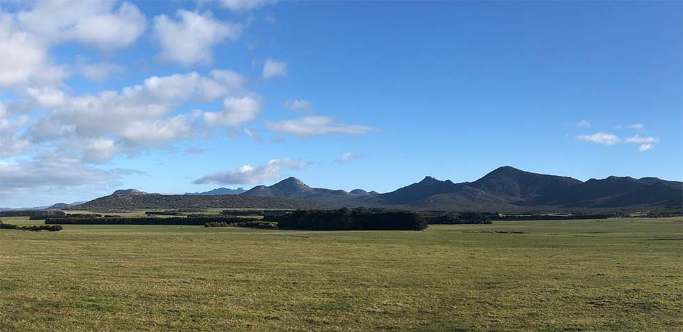
One of the best ways to appreciate the striking skylines etched out along the Darling Range is along a drive up Lackrana Road running up the eastern side of Flinders Island.
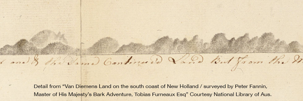
Another is to look at the view sketched by Peter Fanin on board the HMS Adventure as it sailed past the island in April 1773.
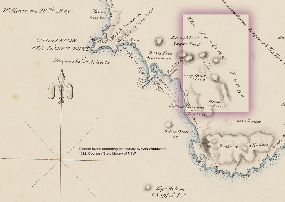
The name of the Darling Range appeared on the 1832 map of Flinders Island. This is coincidental with the work of Ralph Darling as governor of New South Wales (which the included Victoria and Queensland) from 1826 to 1831.
Darling left the colony under a cloud in that year amidst controversy over his harsh treatment of convicts.
Perhaps the coincidence of his name appearing on a major feature at Flinders Island around this time was a way of the Tasmanian Governor George Arthur showing his support for his northern colleague??