MOUNT LEVENTHORPE
Highpoint on the range
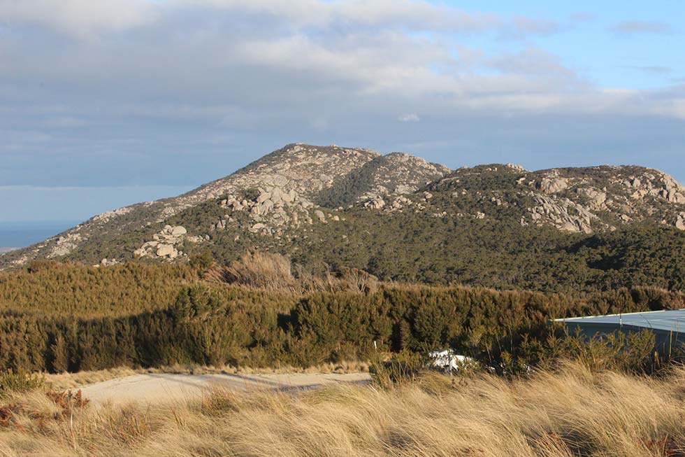
Standing 502m above sea level, Mount Leventhorpe is a defining feature at the top of the Darling Range. It is however a very difficult place to get to as sshown by the granite boulder strewn slopes around the summit. These are hard enough to walk amongst - let alone guide a road through.
Looking across to the peak you can almost trace out the point where the granite emerges from the landscape. This occurs as the hard-baked (metamorphic) ancient sediments on which Walkers Lookout stands make way for the start of the granite country leading south from here.
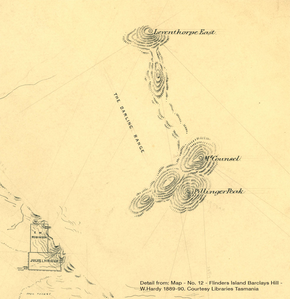
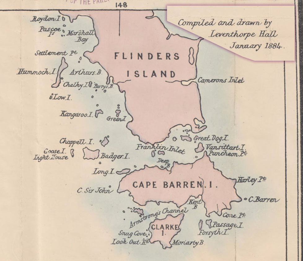
It appears that the name Leventhorpe was applied to the peak at some point in the 1880s. Its original title as Leventhorpe East suggests that the ground at Walkers Lookout must have been thought of as Leventhorpe West, but if so, the name never caught on.
One guess at where the title Leventhorpe comes from suggests that it may be a means of local surveyors acknowledging the work of one of their colleagues.
Leventhorpe Hall for example drew a comprehensive map of Tasmania published in January 1884, so perhaps this summit's title is a recognition of the pioneering work of these early surveyors?